 |
Registration District maps: If any part of the map is tinted pink, the Registration District map of that area is missing; however, Cassini has many other mapping series which cover this area.
Click on ‘Choose map type’ and select the appropriate series. |
|
 |
Click on the map and drag to
centre on your exact location. |
|
|
New Large scale Maps! |
|
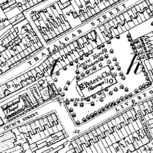
New 25 Inch to the Mile - house level maps (1:2500) for the whole of England and Wales.
Find detailed maps of your area now!
The first maps at 1:2,500 (roughly 25 inches to the mile, or roughly one square inch to one acre) were Published in 1855 with coverage of the cultivated parts of Great Britain being completed in 1896. By then, a
thorough revision had already started; indeed, the process of updating the information and publishing the results in a variety of formats has continued until the present day.
Almost every man-made feature of any significance is displayed on these maps which thus form a definitive record of the changing landscape of Britain since the middle of the 19th century. They are of considerable importance to historians (although this would have been inconceivable to their creators). The detail zooms in to house-level and offers a wealth of additional information concerning land usage, communications and boundaries. For genealogists they are of particular use and interest. Not only do they offer countless research clues which no other source can match but they also reveal every nuance of the landscape inhabited by past generations, so helping to explain many of the preoccupations and limitations that ruled
their lives.
|
Historical maps available. |
1855-1896
County Series
1:2,500 |
|
1880-1910
County Series
1:10,000 |
|
1805-1874
Old Series
1:30,000 - 1:50,000 |
|
1896-1904
Revised New
1:30,000 - 1:50,000 |
|
1919-1926
Popular Edition
1:30,000 - 1:50,000 |
|
1945-1948
New Popular
1:30,000 - 1:50,000 |
|
Present Day
Ordnance Survey
1:30,000 - 1:50,000 |
|
1871
Registration Districts
1:30,000 - 1:50,000 |