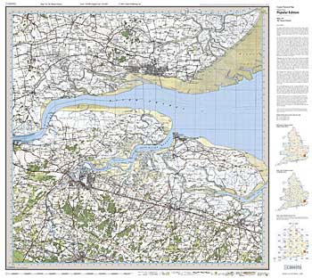
 Britain’s inter-war landscape re-projected and enlarged to match the present-day Ordnance Survey Landrangers® Britain’s inter-war landscape re-projected and enlarged to match the present-day Ordnance Survey Landrangers®
These maps are taken from Ordnance Survey's Popular Edition maps which were first published between 1919 and 1926. They have all been carefully scanned, digitally re-projected and enlarged to match the present-day Ordnance Survey Landranger® series. Each Cassini Popular Edition map is directly comparable with the corresponding Ordnance Survey Landranger® and uses the same sheet number and grid references, so enabling the past and the present to be compared with ease and accuracy.
Cassini's Popular Edition maps have the same name, reference number and coverage as the appropriate Ordnance Survey Landranger®.
|
|
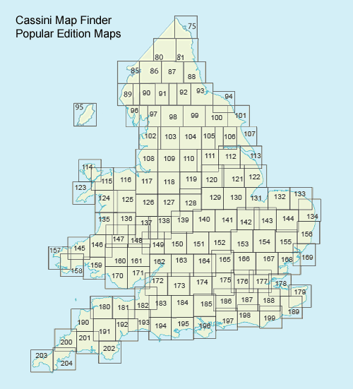
| Choose the map you require |
| By Map Sheet Number |
|
| By Map Sheet Name |
|
By using the Grid Map below |
|
|