|
|
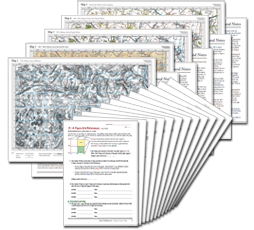
The Cassini MapTeaching Set
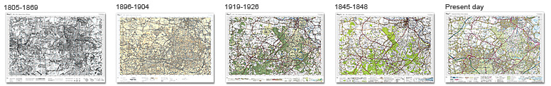
Maps exercise a mysterious power over the imagination. They are also practical and objective guides to understanding the past. The matching set of historical maps that you can create for any area of England & Wales as part of the Cassini Map Teaching Set can be used for a wide range of teaching and learning activities.
And with a lifetime licence for you school, there's nothing further to pay – so, after year 1, they are effectively free historical maps of your area.
As well as the maps, lively and informative background notes provide valuable information for specialist and non-specialist teachers, and for pupils, about how and why and when the maps were created and what features of the changing landscape they help reveal.
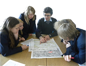
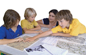
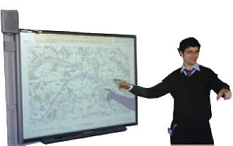
The 12 worksheets (one set for students, one set with teachers' answers) cover a range of topics including transport development, urbanisation, contours, map keys, map reading, points of the compass, grid references and place-name changes and can be used as they stand or as the starting point for bespoke exercises which you have created.
Below are the KS1/2 and KS3 Units in Geography, History and Art & Design for which the Cassini Map Teaching Set will be relevant – but it doesn't need to end there. They can be used to inspire the recollections of older residents during an oral history project, as the basis of practical mathematical exercises considering scales and areas, for a literacy topic involving changing place names, as examples of changing usages in printing technology and graphic design – these maps can be used in any number of ways, as you see best.
KS1/2 Geography
Unit 1. Around our school - the local area
Unit 2. How can we make our local area safer?
Unit 6. Investigating our local area
Unit 8. Improving the environment
Unit 11. Water
Unit 12. Should the high street be closed to traffic?
Unit 13. A contrasting UK locality
Unit 14. Investigating rivers
Unit 19. How and where do we spend our time?
Unit 20. Local traffic - an environmental issue
Unit 21. How can we improve the area we can see from our window?
Unit 25. Geography and numbers
KS3 Geography
Unit 1. Making connections
Unit 5. Exploring England
Unit 7. Rivers - a fieldwork approach
Unit 8. Coastal environments
Unit 9. Shopping - past, present and future
Unit 13. Limestone landscapes of England
Unit 14. Can the earth cope? Ecosystems, population and resources
Unit 15. Crime and the local community
Unit 16. What is development? |
KS1/2 History
Unit 2. What were homes like a long time ago?
Unit 3. What were seaside holidays like in the past?
Unit 11. What was it like for children living in Victorian Britain?
Unit 12. How did life change in our locality in Victorian times?
Unit 13. How has life in Britain changed since 1948?
Unit 18. What was it like to live here in the past?
KS3 History
Unit 1. Introductory unit what's it all about?
Unit 11. Industrial changes action and reaction
Unit 12. Snapshot 1900 what was British middle-class life like?
KS1/2 Art & Design
Unit 4C. Journeys
Unit 6C. A sense of place
KS3 Art & Design
Unit 7C. Recreating landscapes
Unit 9C. Personal places, public spaces |
See what your teaching colleagues think
“These resources are superb”
Diane Swift, Primary Geography Champion & Senior Lecturer ITE, School of Education, University of Wolverhampton
“A really useful, flexible resource with comprehensive teacher notes that improves our subject knowledge and is ideal for non-specialist teachers.”
Lisa Seddon, KS2, Prescot County Primary
“My year 7 geography class liked how the maps showed the changes in the area and I was able to challenge them to work out why the changes had happened.”
Amy Lawrence, Head of Geography, Tollbar BEC
“Relevant across all Key Stages – Year 7 in particular when we introduce map-skills and local studies. We also cover map-skills at GCSE and A-level and the changes to the area these maps reveal is very useful.”
Isabel Lowe, Head of Geography, St Bartholomew’s School
“Up until now it’s been very hard for teachers to obtain local maps they can compare from different time-periods. The technology Cassini has developed to create and deliver mapping will be invaluable to any department studying their local area - because you no longer have to visit a library.”
Adrian Norton, Humanities Consultant
“Any child using these would become competent in map reading and beginning to explore change.”
Alf Wilkinson, Historical Association
“Before children can use historical maps as a tool in genuine local investigation they have to develop a set of skills – which is what this product does.”
Nick Cronin, Educational Advisor
“This has lots of very good activities. I like the idea of using the maps as visual prompts to student thinking and the fact that sound historical knowledge can be gleaned from the exercise, as well as Geography skills.”
Michael Kennard, Mount Grace School
|