The National Archive Registration District Historical Maps
Three easy steps
Step 1 ~ Search for a location
Step 2 ~ Centre and zoom the map
Step 3 ~ Choose the date range and type
Find any location in England and Wales
Maps from 1805 to the present day
Create personalised site centred maps
See how the landscape has changed
over time
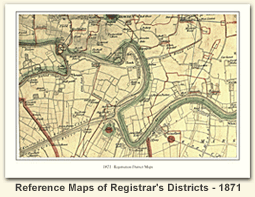
Cassini Publishing, in partnership with The National Archives, as made available on-line digital versions of the original Registration District maps from the 1871 census. This set of maps is the only known collection of this type in the world.
The National Archives give no warranty as to the accuracy, completeness or fitness for the purpose of the information provided.
Images may be used only for purposes of research, private study or education. Applications for any other use should be made to The National Archives Image Library, Kew, Richmond, Surrey TW9 4DU.