Whether your interest in the past involves genealogy, local history, transport, development or discovering the secret history of the landscape where you live or across which you walk, drive or cycle, our maps are invaluable works of reference – historical documents available in a range of modern formats.
"Cassini Historical Maps provide a wonderful key to the past - a key to a treasure-trove for everyone who wants to know what has happened to their world."
Terry Jones, popular TV historian and ex-Monty Python
Printed Sheet Maps
Cassini’s printed maps are digitally enhanced reproductions of original Ordnance Survey maps re-projected and enlarged and reprinted to match the present-day Ordnance Survey Landrangers®. Comparing the past and present has never been easier.
Old Series Edition 1805 to 1874
England & Wales
Revised New Series 1896 to 1904
England & Wales
Popular Edition 1919 to 1926
England & Wales
Past & Present 1805 to the present
Selected cities and towns
Engraved maps from the time of the canal and the horse-drawn cart.
Sepia-toned maps capturing the development of the Late Victorian railway era.
Britain’s first full-colour maps showing the dawn of the motoring age.
64 selected cities and towns, with four maps of four different time periods on one sheet.
Printed Box Sets
3-map Box Sets 1805 to 1926 England & Wales
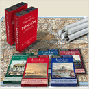
London 5 map Box Set 1805 to today
Selected cities and towns
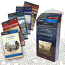
Great British Cities 1805 to 1956 Liverpool
Great British Cities 1805 to 1956 Edinburgh
A set of three matching Cassini maps from three different periods in a presentation box.
These five maps cover London’s history from1805
to 1946 and are available individually or in a box set
In-depth coverage of Liverpool. Four maps of the city and surrounding area and one of the city centre.
In-depth coverage of Edinburgh. Four maps of the city and surrounding area and one map of the city centre.
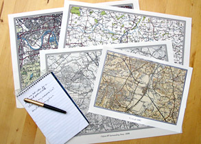
Downloadable Site Centred Maps
Mapmaker Downloadable Maps
Create your own historical map centred on any location in England and Wales and Scotland. Choose from 6 mapping series, from 1805 to the present day.
Ideal for your research needs and now available as instant downloads or professionally printed and sent to you.
From: £5.95
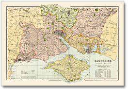
Facsimile Maps
Bacon County Maps
All the counties of England covered in this elegant collection of maps taken from Bacon’s Commercial and Library Atlas of the British Isles of 1900.
Cassini Bacon Atlas rolled maps are available for all counties of England.
Additional maps cover Monmouthshire, The Environs of London and the Isle of Man
& the Channel Islands.