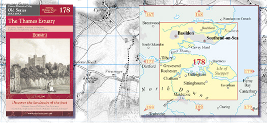
Old Series 178 - The Thames Estuary (1805 - 1819) ISBN 978-1-84736-059-5 Cassini code: OSE-178
-
£ 15.99
£ 0.00
£ 15.99
Old Series 178 - The
Thames Estuary Created from Ordnance Survey one-inch
maps, re-scaled and re-projected to match
Ordnance Survey Landranger®
Key features include:
&bull Same map name and number as the
equivalent
Ordnance Survey Landranger®
&bull Digitally enhanced cartography
&bull British National Grid for ease of
reference
&bull Locator map featuring modern-day
settlements
&bull Sheet indicator showing Old Series maps
used
&bull Robust laminated cover with contemporary
illustration
&bull A brief history and overview of Ordnance
Surveys
Old Series mapping
RRP
Ex VAT
VAT (20%)
Inc VAT
Old Series 178 - The Thames Estuary (1805 - 1819) ISBN 978-1-84736-059-5 Cassini code: OSE-178