|
|
 |
|
 |
|
 |
| New detailed maps of England and Wales! |
|
Large scale 1:2,500 County Series
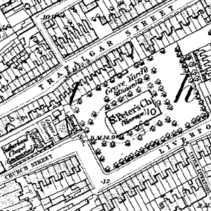
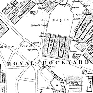
Now that you can download 1:2,500 mapping you can really enter the world you ancestors lived in. Mills, quarries, mines, farms, factories, schools, churches and other significant buildings are all marked.
Cassinimaps Downloads
• Instant map downloads of any area.
• Available for all historical OS series.
• From street level to regional maps.
• Highly customisable.
• 1:2,500 from 1855 to 1896
• Other series from 1805 to the present day
Cassini Maps has added the 1:2,500 County Series (1853- 91) maps of England & Wales to its wide range of mapping. If you have an interest in old maps then Cassini maps are perfect for comparing the past and present.
|
|
To undertake any genealogical research is to make a journey back in time. Navigating your way around this unfamiliar landscape requires maps – which is where Cassini comes in. Our historical maps give you instant access to the past at a range of scales from the early 19th century to the present day. New to Cassini’s map range is the Ordnance Survey 1:2,500 County Series from the late 19th century which zoom in to house-level detail and
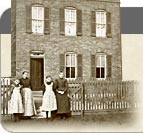
show (and often name) every significant man-made feature, giving a close view of your ancestors’ world, from the house they lived in to the places they worked and worshipped. It’s a unique opportunity to enter the world your ancestors inhabited and to discover practical details, such as changed place names, to help your research.
"Old maps of the sort published by Cassini are an excellent introduction to local history throughout the United Kingdom because they focus the user’s attention on the sort of unexpected questions that act as starting points for research. “Well, I never knew that there was a house in that location 200 years ago”. “I never realised that xxxx Road followed a different course 150 years ago . . . why?”. Of course, detailed local histories will probably contain the answers to some of these questions – but they hardly ever force them on you as vividly– and attractively – as old maps. And, in some cases, you will find yourself asking questions that even the standard histories do not answer. So, before consulting those published histories, look at the maps! "
Peter Barber MA, FSA, FRHistS
Head of Map Collections, British Library
|

| You will need Adobe Reader® to view and print Adobe® PDF files.
If you don't already have it you can download the latest version of Adobe Reader® for free. |
|
|
|
|
|
|
|
| My Basket |

No of items: 0
|
|
your basket is empty
|
|
| Ex VAT | £ 0.00 |
| |
| *Inc VAT | £ 0.00 |
| | | |
| | * where applicable | |
 View Basket View Basket
|
|
|
|