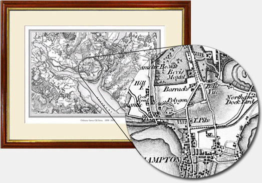
The Old Series maps first published between 1805 and 1869.
These maps were the result of the first ever national survey of England & Wales. From the late 1790s a small army of surveyors covered every corner of the what was still an almost entirely rural country. Their work provided a stunning portrait of the landscape.
When the original maps were created much of the centuries-old fabric of the country was still intact. As a result, they show hamlets, farms, mills woods and numerous other features that have long since been buried under tarmac or concrete. Most aspects of the landscape would have been unchanged for centuries, reminders of ancient patterns of settlement dating back to Saxon times. These fascinating and decorative maps of your area are now available as personalised framed and mounted maps – an elegant reminder of your part of the country as it was in the days of the canal and the horse and cart.
Frequently Asked Questions