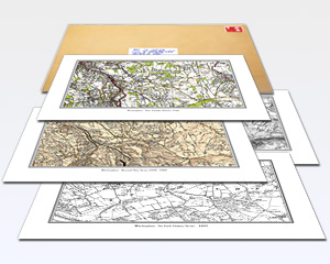
- Printed Maps
- Printed on 130gsm lumi silk paper
- Choose from four mapping series
- Available To fit A3
- Including personal inscription
- Landscape orientation
- Map scales : 1:50,000 to 1:2,500
- Delivered to UK mainland address
Choose from four mapping series, spanning the period 1805 to 1946.
- County Series 1:2,500 - 1855 to 1896 - Almost every man-made feature of any significance is displayed on these maps.
- County Series 1:10,000 - 1880 to 1910 - Ordnance Survey's County Series maps reveal the changing face of Britain.
- Old Series 1:50,000 - 1805 to 1874 - Engraved maps from the time of the canal and the horse-drawn cart.
- Revised New Series 1:50,000 - 1896 to 1904 - Sepia-toned maps capturing the Late Victorian railway era.
- Popular Edition 1:50,000 - 1919 to 1926 - Britain’s first full-colour maps showing the dawn of the motoring age.
- New Popular Edition 1:50,000 - 1945 to 1948 - A record of a battered country at the end of a global war.
Our maps are ideal for anyone who has interest in the history of their area and wishes to trace the changes that it has undergone since the Industrial Revolution. Because we have enlarged the originals to match the scale and projection of the present-day Ordnance Survey Landrangers®, Cassini Historical maps are ideal for comparing the past with the present.