New Popular Edition
 Created from Ordnance Survey New Popular Edition maps first published between 1945 and 1948 Created from Ordnance Survey New Popular Edition maps first published between 1945 and 1948
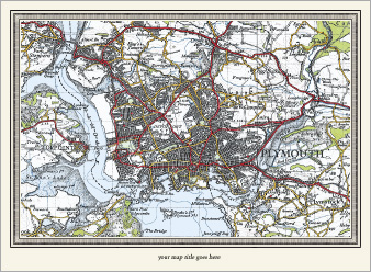
These maps reveal the reality of the outwards spread of urban populations with great clarity. For the first time, the areas covered by the series shows the build-up of towns and cities and their rapid expansion into the countryside. The railways, though now at their maximum extent, are represented on this map far less prominently than are the roads, reflecting their reduced importance. Yet, nestled between the development, there are still plentiful reminders of the region’s more ancient past: numerous farms, orchards and copses are all clearly marked, though many of them have since been buried under layers of concrete and tarmac.
The New Popular Edition is a record of a battered Britain at the end of a global war and nearing the end of a period of global imperialism. If the Old Series describes the age of the horse and cart, the Revised New Colour that of the railways and the Popular Edition that of the dawn of the motor car, the New Popular Edition of the late 1940s is perhaps the map of the urban planner. Many schemes, some city-wide, some local, were proposed in the post-war years: some were implemented, others were not. The New Popular Edition elegantly captures the raw material which planners and developers were to use, for better or for worse, to create the landscape that we know today. |