This map includes the following locations
Arkle Town,
Auckland, West,
Aukside,
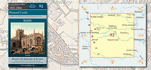
Barnard Castle,
Barningham,
Barras,
Bedburn,
Billy Row,
Bitchburn, North,
Blackdene, East,
Blackdene, West,
Bolam,
Boldron,
Bollihope,
Booze,
Bowbank,
Bowes,
Bowlees,
Bridge End,
Brignall,
Briscoe, East,
Brotherlee,
Butterknowle,
Caldwell,
Cleatlam,
Clints,
Cockfield,
Copley,
Cotherstone,
Craigside,
Crook,
Daddry Shield,
Dalton,
Dent Bank,
Dyke, High,
Easby,
East Blackdene,
East Briscoe,
East Layton,
Eastgate,
Egglesburn,
Eggleston,
Eppleby,
Escomb,
Esperley Lane Ends,
Etherley Dene,
Etherley, High,
Etherley, Low,
Ettersgill,
Evenwood,
Evenwood Gate,
Fir Tree,
Forcett,
Forest-in-Teesdale,
Frosterley,
Gainford,
Gayles,
Gilling West,
Gilmonby,
Grange, High,
Greta Bridge,
Hamsterley,
Hartforth,
Harwood,
Headlam,
Helmington Row,
High Dyke,
High Etherley,
High Grange,
Hill End,
Hill Top,
Hilton,
Ho, New,
Holly Hill,
Holwick,
Howden-le-Wear,
Hudswell,
Hunderthwaite,
Hunwick,
Hunwick, New,
Hurgill,
Hury,
Hutton Magna,
Ingleton,
Inkerman,
Ireshopeburn,
Keld,
Kelton,
Killerby,
Kinninvie,
Kirby Hill,
Laithkirk,
Langdon Beck,
Langthwaite,
Langton,
Lartington,
Layton, East,
Layton, West,
Little Newsham,
Low Etherley,
Marske,
Melsonby,
Mickleton,
Middle Side,
Middleton in Teesdale,
Morley,
Morton Tinmouth,
New Ho,
New Hunwick,
Newbiggin,
Newsham,
Newsham, Little,
North Bitchburn,
North Stainmore,
Ovington,
Pasture, West,
Phoenix Row,
Ramshaw,
Ravenseat,
Ravensworth,
Richmond,
Roddymoor,
Romaldkirk,
Rookby,
Scargill,
Side, Middle,
Side, South,
Skeeby,
Slack, The,
Snaisgill,
South Side,
South Stainmore,
St. Helen Auckland,
St. John's Chapel,
Staindrop,
Stainmore, North,
Stainmore, South,
Stainton,
Stanhope,
Stanley Crook,
Startforth,
Stonesdale, West,
Sunniside,
Sunny Brow,
The Slack,
Thornley,
Thorns,
Thringarth,
Tindale Crescent,
Toft Hill,
Toronto,
Tow Law,
Town, Upper,
Upper Town,
Wackerfield,
Washfold,
Wearhead,
West Auckland,
West Blackdene,
West Layton,
West Pasture,
West Stonesdale,
Westgate,
Westwick,
Whashton,
Whaw,
Whorlton,
Willington,
Winston,
Witton Park,
Witton-le-Wear,
Wolsingham,
Woodland,
Woodside,
Wycliffe,
|