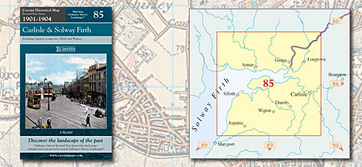
This map includes the following locations
Abbeytown,
Aglionby,
Aikton,
Aldoth,
Allonby,
Angerton,
Anthorn,
Aspatria,
Baggrow,
Baldwinholme,
Bampton, Little,
Barclose,
Beaumont,
Beckfoot,
Belah,
Belle Vue,
Biglands,
Blackdyke,
Blackford,
Blackwell,
Blencogo,
Blennerhasset,
Blitterlees,
Bolton Low Houses,
Bolton New Houses,
Bolton Wood Lane,
Boltongate,
Border,
Botcherby,
Boustead Hill,
Bowness-on-Solway,
Brackenlands,
Brackenthwaite,
Braithwaite, Low,
Bridge End,
Brisco,
Bromfield,
Broomfield,
Brothybeck,
Brunstock,
Buckabank,
Burgh by Sands,
Burthwaite,
Calvo,
Cardew,
Cardewlees,
Cardurnock,
Cargo,
Carleton,
Carlisle,
Carlisle, Old,
Carwinley,
Chalkfoot,
Churchtown,
Cowper, New,
Crofton,
Crookdake,
Cumdivock,
Cummersdale,
Currock,
Curthwaite, East,
Curthwaite, West,
Dalston,
Denton Holme,
Down Hall,
Drumburgh,
Dundraw,
Durdar,
East Curthwaite,
Easton,
Easton,
Edderside,
Edentown,
End, North,
End, West,
Etterby,
Fingland,
Fletchertown,
Foulbridge,
Gaitsgill,
Gamelsby,
Garlands,
Glasson,
Goodyhills,
Grassgarth,
Great Orton,
Green Head,
Greenrow,
Grinsdale,
Harker,
Harraby,
Harriston,
Hawksdale,
Hayton,
Hetherside,
High Longthwaite,
High Scales,
High Whinnow,
Highbridge,
Highlaws,
Highmoor,
Holme St Cuthbert,
Houghton,
Hurst,
Ivegill,
Kelsick,
Kingside Hill,
Kingstown,
Kirkandrews-on-Eden,
Kirkbampton,
Kirkbride,
Kirkland,
Kirkland Guards,
Kirklinton,
Knowefield,
Langrigg,
Lessonhall,
Linstock,
Little Bampton,
Little Orton,
Longburgh,
Longcroft,
Longpark,
Longsowerby,
Longthwaite, High,
Longtown,
Low Braithwaite,
Low Row,
Low Whinnow,
Mawbray,
Mealrigg,
Mealsgate,
Mellguards,
Micklethwaite,
Middlesceugh,
Moat,
Monkhill,
Moor Row,
Moorend,
Moorhouse,
Moorhouse,
Morton,
Moss Side,
Nealhouse,
Nether Welton,
Netherby,
New Cowper,
Newby West,
Newton Arlosh,
Newtown,
Newtown,
North End,
Old Carlisle,
Orton Rigg,
Orton, Great,
Orton, Little,
Oughterby,
Oughterside,
Oulton,
Park Broom,
Parkgate,
Parkhead,
Parton,
Pelutho,
Port Carlisle,
Powhill,
Prospect,
Raby,
Ratten Row,
Ratten Row,
Raughton,
Raughton Head,
Red Dial,
Rickerby,
Rockcliffe,
Rockcliffe Cross,
Rosley,
Row, Low,
Salt Cotes,
Salta,
Sandale,
Scaleby,
Scalebyhill,
Scales, High,
Scotby,
Scuggate,
Seaville,
Sebergham,
Silloth,
Skinburness,
Skiprigg,
Skitby,
Smithfield,
Sour Nook,
Sowerby Row,
Sprunston,
Stainton,
Standingstone,
Stanwix,
Station Hill,
Stockdalewath,
Stone Raise,
Tarns,
Tarraby,
Thethwaite,
Thomas Close,
Thornby,
Thursby,
Thurstonfield,
Todhills,
Unthank,
Upperby,
Walby,
Wampool,
Warwicksland,
Watchhill,
Waterside,
Waverbridge,
Waverton,
Welton,
Welton, Nether,
West Curthwaite,
West End,
Western Bank,
Westlinton,
Westnewton,
Westward,
Whinnow, High,
Whinnow, Low,
Whiteclosegate,
Whitrigg,
Wiggonby,
Wigton,
Willow Holme,
Wolsty,
Woodhouses,
Woodrow,
Wreay,
Yearngill,
|