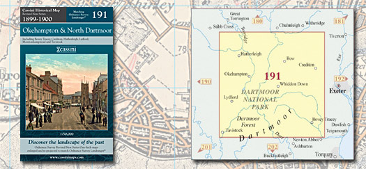
This map includes the following locations
Ashbury,
Ashridge Court,
Ashton, Lower,
Babeny,
Barwick,
Batworthy,
Bellever,
Belstone,
Belstone Corner,
Bennah,
Berner's Cross,
Bickington,
Bidlake,
Bilsdon,
Black Dog,
Blackpool,
Boasley Cross,
Bondleigh,
Bonehill,
Bovey Tracey,
Bovey, North,
Bow,
Bridestowe,
Bridford,
Bridfordmills,
Brightley,
Brimley,
Broadbury,
Broadwoodkelly,
Brook,
Brushford,
Buckland in the Moor,
Burston,
Butts,
Cator, Lower,
Chagford,
Cheriton Bishop,
Cheriton Cross,
Cheriton Fitzpaine,
Chichacott,
Christow,
Chudleigh,
Chudleigh Knighton,
Coldeast,
Coldridge,
Colebrooke,
Coleford,
Combebow,
Copplestone,
Court Barton,
Crediton,
Creedy, Lower,
Crockernwell,
Crowden,
Dartmeet,
Doccombe,
Doddiscombsleigh,
Dowland,
Down St Mary,
Drewsteignton,
Dunsford,
Dunstone,
East Kimber,
East Leigh,
East Village,
East Week,
Eastington,
Easton,
Eggesford Station,
Elston,
Exbourne,
Farrants,
Filleigh,
Fishleigh,
Fishleigh Castle,
Folly Gate,
Forda,
Fordton Mill,
Frenchbeer,
Frost,
Gappah,
Gidleigh,
Gooseford,
Great Weeke,
Green Lane,
Hatherleigh,
Haytor Vale,
Heath Cross,
Heath Cross,
Heathercombe,
Heathfield,
Hennock,
Hexworthy,
Highampton,
Higher Ashton,
Highweek,
Hillerton,
Hittisleigh Barton,
Hollacombe,
Hollocombe,
Hollocombe Town,
Honeychurch,
Hookner, Lower,
Hookway,
Huish,
Iddesleigh,
Ilsington,
Ingleigh Green,
Inwardleigh,
Jacobstowe,
Jurston,
Kennerleigh,
Kimber, East,
Knighton, South,
Knowle,
Lake,
Langstone,
Lapford,
Lapford Cross,
Leigh, East,
Leigh, West,
Lettaford,
Lewthorn Cross,
Little Silver,
Littleborough,
Liverton,
Longdown,
Lower Ashton,
Lower Cator,
Lower Creedy,
Lower Hookner,
Lustleigh,
Lustleigh Cleave,
Manaton,
Meeth,
Meldon,
Middlecott,
Middlecott,
Mile End,
Monkokehampton,
Morchard Bishop,
Moretonhampstead,
Murchington,
Neopardy,
Newbuildings,
Norley,
North Bovey,
North Tawton,
North Town,
Northlew,
Nymet Rowland,
Nymet Tracey,
Oak Cross,
Odham,
Okehampton,
Oldborough,
Padson,
Park,
Patchacott,
Pathfinder Village,
Pennymoor,
Penstone,
Perry Green,
Petrockstowe,
Ponsworthy,
Postbridge,
Poughill,
Poundsgate,
Preston,
Princetown,
Prowse,
Puddington,
Ramsley,
Reedy,
Rowden,
Sampford Chapple,
Sampford Courtenay,
Sandford,
Sandford, West,
Sandygate,
Sheepwash,
Shobrooke,
Sigford,
Silver, Little,
Skaigh,
Sloncombe,
Smallbrook,
Sourton,
South Knighton,
South Tawton,
South Yeo,
South Zeal,
Southerly,
Sowton Barton,
Splatt,
Spreyton,
Sticklepath,
Stockleigh English,
Taw Green,
Tawton, North,
Tawton, South,
Tedburn St Mary,
Teign Village,
Teigngrace,
Thorn,
Thorndon Cross,
Throwleigh,
Town Barton,
Town, North,
Trecott,
Trusham,
Two Bridges,
Upcott,
Upcott,
Upton Hellions,
Uton,
Venny Tedburn,
Village, East,
Washford Pyne,
Water,
Week, East,
Weeke,
Weeke, Great,
Welstor,
Wembworthy,
West Leigh,
West Sandford,
Westwood,
Whiddon Down,
Whitestone,
Widecombe in the Moor,
Winkleigh,
Wonson,
Woodland Head,
Woolfardisworthy,
Woolsgrove,
Wreyland,
Yeo, South,
Yeoford,
Zeal Monachorum,
Zeal, South,
|