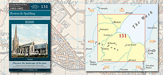
This map includes the following locations
Algakirk,
Anton's Gowt,
Asperton,
Austendike,
Baythorpe,
Bellmount,
Belnie,
Benington,
Benington Sea End,
Bicker,
Bicker Bar,
Bicker Gauntlet,
Black Barn,
Blackjack,
Boston,
Boston Long Hedges,
Boston West,
Brand End,
Brotherhouse Bar,
Brothertoft,
Bucklegate,
Burtoft,
Burton Corner,
Butterwick,
Cackle Hill,
Chain Bridge,
Chapelgate,
Church End,
Church End,
Clark's Hill,
Clay Lake,
Clenchwarton,
Common, Little,
Cowbit,
Cowbridge,
Crossgate,
Dawsmere,
Deeping St Nicholas,
Donington,
Donington Eaudike,
Donington South Ing,
Drayton,
Eau Brink,
Emorsgate,
End, North,
End, West,
Fen End,
Fenhouses,
Ferry, High,
Fishmere End,
Fishtoft,
Fishtoft Drove,
Fleet,
Fleet Hargate,
Fosdyke,
Fosdyke Bridge,
Foul Anchor,
Four Gotes,
Frampton,
Frampton West End,
Freiston,
Freiston Shore,
Frith Bank,
Fulney,
Fulney, Low,
Garnsgate,
Gate, Old,
Gedney,
Gedney Drove End,
Gedney Dyke,
Gipsey Bridge,
Gosberton,
Gosberton Cheal,
Green, South,
Guy's Head,
Halesgate,
Haltoft End,
Hay Green,
Hedgehog Bridge,
High Ferry,
Hilldyke,
Hoffleet Stow,
Holbeach,
Holbeach Bank,
Holbeach Clough,
Holbeach Hurn,
Holbeach St John,
Holbeach St Marks,
Holbeach St Mattew,
Holland Fen,
Hubbert's Bridge,
Hurn's End,
Ingleborough,
Kirton,
Kirton End,
Kirton Holme,
Langrick,
Langrick Bridge,
Leake,
Leverton,
Leverton Highgate,
Leverton Lucasgate,
Leverton Outgate,
Little Common,
Little London,
Little London,
Little Sutton,
London, Little,
London, Little,
Long Sutton,
Loosegate,
Low Fulney,
Lutton,
Lutton Gowts,
Manor Hill Corner,
Moulton,
Moulton Chapel,
Moulton Eaugate,
Moulton Seas End,
Newton,
North End,
Northorpe,
Old Gate,
Orange Row,
Peak Hill,
Penny Hill,
Pinchbeck,
Pinchbeck West,
Pode Hole,
Port Sutton Bridge,
Quadring,
Quadring Eaudike,
Reed Point,
Risegate,
Sandholme,
Saracen's Head,
Scrane End,
Seadyke,
Shepherd's Gate,
Skeldyke,
Skirbeck,
Skirbeck Quarter,
South Green,
Spalding,
St. John's Highway,
Strugg's Hill,
Surfleet,
Surfleet Seas End,
Sutterton,
Sutterton Dowdyk,
Sutton Bridge,
Sutton Corner,
Sutton Crosses,
Sutton St James,
Sutton, Little,
Sutton, Long,
Swineshead,
Swineshead Bridge,
Tamworth Green,
Terrington St Clement,
Terrington St John,
Tilney All Saint,
Tilney High End,
Tydd Gote,
Tydd St Giles,
Tydd St Mary,
Walpole Cross Keys,
Walpole Marsh,
Walpole St Andrew,
Walpole St Peter,
Wargate,
Wash Dyke,
West End,
Westhorpe,
Weston,
Weston Hills,
Whaplode,
Wiggenhall St Germans,
Wigtoft,
Willoughby Hills,
Wyberton,
Wykeham,
|