This map includes the following locations
Aisby,
Allington,
Ancaster,
Asgarby,
Ashwell,
Askerton Hill,
Aslackby,
Aswarby,
Aunby,
Aunsby,
Barkston,
Barrow,
Barrowby,
Bassingthorpe,
Bassingthorpe, Lower,
Baston,
Belmesthorpe,
Belton,
Belvoir,
Bennington, Long,
Bescaby,
Billingborough,
Birkholme,
Birthorpe,
Bitchfield,
Boothby Pagnell,
Bottesford,
Boughton,
Bourne,
Braceby,
Brandon,
Branston,
Bridge End,
Buckminster,
Bulby,
Burley,
Burton Pedwardin,
Burton-le-Coggles,
Bytham, Little,
Careby,
Carlton Scroop,
Castle Bytham,
Cawthorpe,
Caythorpe,
Claypole,
Clipsham,
Cold Harbour,
Cold Overton,
Colsterworth,
Corby Glen,
Coston,
Cottesmore,
Cranwell,
Creeton,
Croxton Kerrial,
Culverthorpe,
Dembleby,
Denton,
Dowsby,
Dry Doddington,
Dunsby,
Dyke,
Earlsfield,
East Heckington,
Easthorpe,
Easton,
Edenham,
Edmondthorpe,
Essendine,
Evedon,
Ewerby,
Ewerby Thorpe,
Exton,
Folkingham,
Foston,
Freeby,
Frieston,
Garthorpe,
Gelston,
Gonerby Hill Foot,
Gonerby, Great,
Gosberton Clough,
Graby,
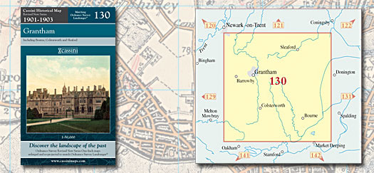
Grantham,
Great Gonerby,
Great Hale,
Great Ponton,
Green Hill,
Greetham,
Grimsthorpe,
Gunby,
Guthram Gowt,
Haceby,
Haconby,
Hale, Great,
Hale, Little,
Hanby,
Hanthorpe,
Harlaxton,
Harston,
Hawthorpe,
Heckington,
Heckington, East,
Helpringham,
Heydour,
Holdingham,
Honington,
Horbling,
Hougham,
Hough-on-the-Hill,
Howell,
Humby,
Hungerton,
Ingoldsby,
Irnham,
Keisby,
Kelby,
Kilvington,
Kirkby la Thorpe,
Kirkby Underwood,
Knipton,
Kyme, South,
Langham,
Laughton,
Leasingham,
Lenton,
Little Bytham,
Little Hale,
Little Ponton,
Little Wisbeach,
Lobthorpe,
Londonthorpe,
Long Bennington,
Lower Bassingthorpe,
Manthorpe,
Manthorpe,
Market Overton,
Marston,
Millthorpe,
Morton,
Muston,
Newton,
Normanton,
Normanton,
North Rauceby,
North Witham,
Northbeck,
Northgate,
Northorpe,
Oasby,
Obthorpe Lodge,
Old Somerby,
Osbournby,
Overton, Market,
Pickworth,
Pickworth,
Pinchbeck West,
Pointon,
Ponton, Great,
Ponton, Little,
Quarrington,
Rauceby, North,
Rauceby, South,
Rippingale,
Ropsley,
Ryhall,
Saltby,
Sapperton,
Saxby,
Scotland,
Scott Willoughby,
Scredington,
Sedgebrook,
Sempringham,
Sewstern,
Silk Willoughby,
Skillington,
Sleaford,
Somerby, Old,
South Kyme,
South Rauceby,
South Witham,
Spanby,
Spittlegate,
Sproxton,
Stainby,
Stainfield,
Stapleford,
Staunton in the Vale,
Stenwith,
Stoke Rochford,
Stonesby,
Stretton,
Stroxton,
Stubton,
Sudbrook,
Swarby,
Swaton,
Swayfield,
Swinstead,
Syston,
Teigh,
Thetford,
Thistleton,
Thorpe Latimer,
Threekingham,
Thurlby,
Toft,
Tongue End,
Twenty,
Walcot,
Waltham on the Wolds,
Welby,
West Willoughby,
Westborough,
Westby,
Whissendine,
Willoughby, West,
Wilsford,
Wisbeach, Little,
Witham on the Hill,
Witham, North,
Witham, South,
Woodnook,
Woolsthorpe By Belvoir,
Woolsthorpe-by-Colsterworth,
Wymondham,
Wyville,
|