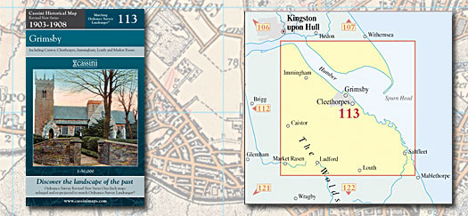
This map includes the following locations
Alvingham,
Ashby cum Fenby,
Ashby Hill,
Austen Fen,
Aylesby,
Barnoldby le Beck,
Beelsby,
Berrygate Hill,
Binbrook,
Bradley,
Bradley,
Brigsley,
Brocklesby,
Brookenby,
Cabourne,
Caistor,
Canada,
Church End,
Claxby,
Clee, Old,
Cleethorpes,
Clixby,
Coates, Great,
Coates, Little,
Cockerington, North,
Conisholme,
Cotes, North,
Covenham St Bartholomew,
Covenham St Mary,
Croxby,
Croxby Top,
Cuxwold,
Donna Nook,
Easington,
East Halton,
East Marsh,
East Ravendale,
Elkington, North,
End, North,
End, North,
End, North,
End, South,
End, West,
Eskham,
Field, West,
Fotherby,
Fulstow,
Goxhill,
Grainsby,
Grainthorpe,
Grainthorpe Fen,
Grange,
Grant Thorold,
Great Coates,
Great Limber,
Great Tows,
Grimsby,
Grimsby, Little,
Habrough,
Halton, East,
Hatcliffe,
Healing,
Heathfield,
Hollym,
Holme Hill,
Holmpton,
Holton le Clay,
Humberston,
Humberston Fitties,
Immingham,
Irby upon Humber,
Keelby,
Kelstern,
Keyingham,
Killingholme, North,
Killingholme, South,
Kilnsea,
Kirmington,
Kirmond le Mire,
Laceby,
Laceby Acres,
Limber, Great,
Limber, Little,
Little Coates,
Little Grimsby,
Little Limber,
Littlefield,
Ludborough,
Ludney,
Marsh, East,
Marsh, West,
Marshchapel,
Nettleton,
Nettleton Top,
New Waltham,
Normanby le Wold,
North Cockerington,
North Cotes,
North Elkington,
North End,
North End,
North End,
North Killingholme,
North Ormsby,
North Somercotes,
North Thoresby,
Nunsthorpe,
Old Clee,
Ormsby, North,
Otby,
Ottringham,
Out Newton,
Patrington,
Patrington Haven,
Poplar Grove,
Pyewipe,
Ravendale, East,
Ravendale, West,
Riby,
Rimac,
Risby,
Rothwell,
Ryehill,
Saltfleet,
Saltfleetby All Saints,
Saltfleetby St Clement,
Sandbraes,
Scartho,
Skeffling,
Skidbrooke,
Skidbrooke North End,
Somercotes, North,
Somercotes, South,
South End,
South Killingholme,
South Somercotes,
Stainton le Vale,
Stallingborough,
Sunk Island,
Swallow,
Swinhope,
Tealby,
Tetney,
Tetney Lock,
The Willows,
Thoresby, North,
Thoresway,
Thorganby,
Thorpe le Vale,
Toby's Hill,
Tows, Great,
Ulceby,
Ulceby Skitter,
Utterby,
Waithe,
Walesby,
Walesby Grange,
Waltham,
Waltham, New,
Weelsby,
Weeton,
Wellow,
Welwick,
West End,
West Field,
West Marsh,
West Ravendale,
Willows, The,
Winestead,
Wold Newton,
Wragholme,
Wybers Wood,
Yarborough,
Yarburgh,
|