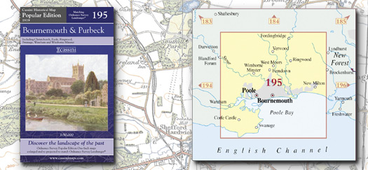
This map includes the following locations
Acton,
Alderholt,
Alderney,
Almer,
Ameysford,
Arne,
Ashford,
Ashington,
Ashley,
Ashley,
Ashley Clinton,
Ashley Heath,
Avon,
Bank,
Barrow Hill,
Barton on Sea,
Bashley,
Bashley Park,
Beacon Hill,
Bear Cross,
Bearwood,
Beckley,
Bickton,
Birchy Hill,
Bisterne,
Bisterne Close,
Blackwater,
Blandford Camp,
Blandford, Lower,
Blashford,
Bleak Hill,
Blissford,
Blockhampton, Middle,
Blockhampton, North,
Blockhampton, South,
Bloxworth, East,
Boscombe,
Bourne Valley,
Bournemouth,
Boveridge,
Branksome,
Branksome Park,
Bransgore,
Broadstone,
Brook,
Brook Hill,
Broom Hill,
Buildings, New,
Burley,
Burley Beacon,
Burley Lawn,
Burley Street,
Burton,
Bushey,
Camel Green,
Canford Cliffs,
Canford Heath,
Canford Magna,
Canford, Little,
Canterton, Upper,
Cashmoor,
Chalbury,
Chalbury Common,
Charlton Marshal,
Charlton on the Hill,
Charminster,
Chettle,
Chilbridge,
Christchurch,
Church Knowle,
Clapgate,
Cliff, West,
Cocknowle,
Cold Harbour,
Colehill,
Combe Almer,
Corfe Castle,
Corfe Mullen,
Cowgrove,
Crab Orchard,
Cranborne,
Creech,
Creech Bottom,
Creech, East,
Creekmoor,
Crendell,
Crichel, Long,
Criddlestyle,
Cripplestyle,
Crooked Withies,
Crow,
Daggons,
Daggons, Lower,
Dewlands Common,
Downton,
Dudsbury,
Durns Town,
East Bloxworth,
East Creech,
East End,
East Holme,
East Holton,
East Howe,
East Morden,
East Parley,
Ebblake,
Edmondsham,
Ellingham,
Emery Down,
End, East,
End, West,
Ensbury,
Ensbury Park,
Fairmile,
Ferndown,
Fordingbridge,
Foulford,
Friars Cliff,
Fritham,
Frogham,
Furze Hill,
Furzebrook,
Furzehill,
Gaunt's Common,
God's Blessing Green,
Godshill,
Godswinscroft,
Golden Hill,
Gorley, North,
Gorley, South,
Gotham,
Grange,
Grange Estate,
Gussage All Sain,
Gussage St Andrew,
Gussage St Michael,
Hampreston,
Hamworthy,
Hamworthy, Lower,
Hangersley,
Harbridge,
Harbridge Green,
Harman's Cross,
Haythorne,
Hemsworth,
Henbury,
Herston,
Highcliffe,
Higher Row,
Hightown,
Highwood,
Hill View,
Hillbourne,
Hillbutts,
Hinton,
Hinton Martell,
Hinton Parva,
Hogstock,
Holdenhurst,
Holme, East,
Holmebridge,
Holt,
Holt Heath,
Holt Wood,
Holton, East,
Holwell, Lower,
Hordle,
Horton,
Horton Common,
Horton Heath,
Hound Hill,
Howe, East,
Howe, West,
Hurn,
Hurn, West,
Hyde,
Ibsley,
Iford,
Jumpers Common,
Kimmeridge,
Kingston,
Kingston,
Kingston, North,
Kinson,
Knighton,
Knowlton,
Lake,
Lambs Green,
Langton Long Blandford,
Langton Matraver,
Leagreen,
Leigh,
Lilliput,
Linford,
Linwood,
Little Canford,
Little Woolgarst,
Littledown,
Littleton,
London Minstead,
Long Crichel,
Longfleet,
Longham,
Lower Blandford,
Lower Daggons,
Lower Hamworthy,
Lower Holwell,
Lower Mannington,
Lower Row,
Lower Turmer,
Lytchett Matrave,
Lytchett Minster,
Mannington,
Mannington, Lower,
Manswood,
Mapperton,
Mead End,
Merley,
Merritown,
Merry Field Hill,
Meyrick Park,
Middle Blockhampton,
Milford on Sea,
Milton, New,
Milton, Old,
Minchington,
Minstead,
Mockbeggar,
Monkton Up Wimborne,
Moordown,
Moors, West,
Moortown,
Morden,
Morden, East,
Morden, West,
More Crichel,
Mudeford,
Muscliff,
Neacroft,
New Buildings,
New Milton,
New Swanage,
New Town,
Newgrounds,
Newton Peveril,
Newtown,
Newtown,
Norden,
North Blockhampton,
North Gorley,
North Kingston,
North Poulner,
North Ripley,
North Weirs,
Northbourne,
Northport,
Oakdale,
Oakley,
Ogdens,
Old Milton,
Organford,
Ossemsley,
Pamphill,
Parkstone,
Parley Green,
Parley, East,
Parley, West,
Picket Hill,
Pig Oak,
Pilford,
Pimperne,
Pokesdown,
Poole,
Post Green,
Poulner,
Poulner, North,
Purewell,
Red Hill,
Ridge,
Ringwood,
Ripley,
Ripley, North,
Rockford,
Romford,
Rossmore,
Row, Lower,
Rushcombe Bottom,
Sandbanks,
Sandford,
Sandford,
Sandleheath,
Shapwick,
Sherford,
Shirley,
Shobley,
Sleight,
Slepe,
Somerford,
Sopley,
South Blockhampton,
South Gorley,
South Weirs,
Southbourne,
Southbourne, West,
Spetisbury,
Springbourne,
St. Catherine's Hill,
St. Ives,
St. Leonards,
Stanbridge,
Stanley Green,
Stanpit,
Stapehill,
Steeple,
Sterte,
Stoborough,
Stoborough Green,
Stoney Cross,
Strouden,
Stubhampton,
Stuckton,
Studland,
Sturminster Marshall,
Sutton Holms,
Swanage,
Swanage, New,
Sway,
Tadden,
Talbot Heath,
Talbot Village,
Talbot Woods,
Tarrant Crawford,
Tarrant Gunville,
Tarrant Hinton,
Tarrant Keyneston,
Tarrant Launceston,
Tarrant Monkton,
Tarrant Rushton,
Thorney Hill,
Three Legged Cross,
Throop,
Tiptoe,
Town, New,
Town's End,
Trickett's Cross,
Tuckton,
Turbary Common,
Turlin Moor,
Turmer,
Turmer, Lower,
Ulwell,
Upper Canterton,
Uppington,
Upton,
Verwood,
Walkford,
Wallisdown,
Wareham,
Waterditch,
Waterloo,
Weirs, North,
Weirs, South,
West Cliff,
West End,
West Howe,
West Hurn,
West Moors,
West Morden,
West Parley,
West Southbourne,
Westbourne,
Whitefield,
Whitmore,
Wick,
Wigbeth,
Wimborne Minster,
Wimborne St Giles,
Winkton,
Winterborne Zelston,
Winton,
Witchampton,
Wittensford,
Woodlands,
Woodlands Common,
Woolgarst, Little,
Woolgarston,
Woolsbridge,
Wootton,
Worgret,
Worth Matravers,
|