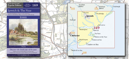
This map includes the following locations
Aingers Green,
Akenham,
Alderton,
Balls Green,
Bath Side,
Bawdsey,
Beacon Hill,
Bealings, Great,
Bealings, Little,
Beaumont,
Belstead,
Bentley, Great,
Bentley, Little,
Bergholt, East,
Blacksmith's Corner,
Blakenham, Little,
Bocking's Elm,
Boot Street,
Boyton,
Bradfield,
Bradfield Heath,
Bramford,
Brantham,
Brightlingsea,
Brightwell,
Broke Hall,
Bromley, Great,
Bromley, Little,
Broom Hill,
Bucklesham,
Burrsville Park,
Burstall,
Burstallhill,
Butley High Corner,
Butley Low Corner,
California,
Capel Green,
Capel St Andrew,
Capel St Mary,
Castle Hill,
Cattawade,
Chantry,
Chattisham,
Chelmondiston,
Church End,
Clacton, Great,
Clacton, Little,
Clacton-On-Sea,
Claydon,
Coles Green,
Cook's Green,
Copdock,
Culpho,
Dovercourt,
Dovercourt, Upper,
Duck Corner,
East Bergholt,
East End,
End, East,
Erwarton,
Falkenham,
Falkenham Sink,
Falkenham, Lower,
Felixstowe,
Felixstowe Ferry,
Felixstowe, Old,
Flowton,
Foxash Estate,
Frating,
Frating Green,
Freston,
Frinton-On-Sea,
Gainsborough,
Gedgrave Hall,
Gipsy Row,
Goose Green,
Goose Green,
Great Bealings,
Great Bentley,
Great Bromley,
Great Clacton,
Great Holland,
Great Oakley,
Great Wenham,
Greenwich,
Hare Green,
Harkstead,
Harwich,
Heath, South,
Heath, The,
Hemley,
Hintlesham,
Holbrook,
Holbrook, Lower,
Holland, Great,
Holland-on-Sea,
Hollesley,
Hollybush Hill,
Horsley Cross,
Horsleycross Street,
Hurst Green,
Ipswich,
Jaywick,
Kesgrave,
Kingston,
Kirby Cross,
Kirby-le-Soken,
Kirton,
Larks' Hill,
Lattinford Hill,
Lawford,
Lee-over-Sands,
Levington,
Little Bealings,
Little Bentley,
Little Blakenham,
Little Bromley,
Little Clacton,
Little Oakley,
Little Wenham,
Lower Falkenham,
Lower Holbrook,
Lower Street,
Mace Green,
Maidenhall,
Maidensgrave,
Manningtree,
Martlesham,
Martlesham Heath,
Methersgate,
Mill Hills,
Mistley,
Mistley Heath,
Mistley, New,
Nacton,
Nettlestead,
New Mistley,
Newbourne,
Oak Hill,
Oakley, Great,
Oakley, Little,
Old Felixstowe,
Orford,
Parkeston,
Playford,
Point Clear,
Port of Felixstowe, The,
Potash,
Priory Heath,
Racecourse,
Ramsey,
Ramsholt,
Raven's Green,
Rose Hill,
Row Heath,
Rush Green,
Rushmere St Andrew,
Rushmere Street,
Seawick,
Shingle Street,
Shop Corner,
Shotley,
Shotley Gate,
Shottisham,
Somersham,
South Heath,
Sproughton,
St. Osyth,
St. Osyth Heath,
Stoke,
Stoke Park,
Stones Green,
Street, Lower,
Street, Upper,
Stutton,
Sutton,
Sutton Street,
Tattingstone,
Tattingstone White Horse,
Tendring,
Tendring Green,
Tendring Heath,
The Heath,
The Port of Felixstowe,
The Woodlands,
Thorpe Common,
Thorpe Green,
Thorpe-le-Soken,
Thorrington,
Tower Hill,
Trimley Lower Street,
Trimley St Martin,
Trimley St Mary,
Tuddenham,
Upper Dovercourt,
Upper Street,
Waldringfield,
Waldringfield Heath,
Walton,
Walton-On-The-Naze,
Warren Heath,
Washbrook,
Washbrook Street,
Weeley,
Weeley Heath,
Wenham, Great,
Wenham, Little,
Westbourne,
Westerfield,
Wherstead,
Whight's Corner,
White House,
Whitton,
Wix,
Woodbridge,
Woodbridge Walk,
Woodlands, The,
Woolverstone,
Wrabness,
|