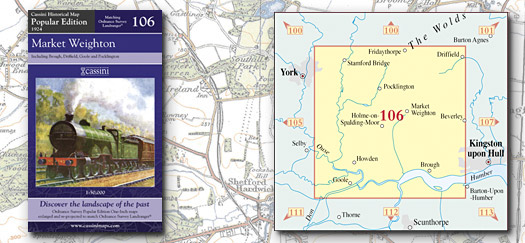
This map includes the following locations
Airmyn,
Airmyn, Little,
Allerthorpe,
Asselby,
Aughton,
Bainton,
Balkholme,
Barlby,
Barlow,
Barmby Moor,
Barmby on the Marsh,
Bellasize,
Bennetland,
Bielby,
Bishop Burton,
Bishop Wilton,
Bolton,
Boothferry,
Brantingham,
Breighton,
Brind,
Broad Ings,
Broomfleet,
Brough,
Bubwith,
Bugthorpe,
Burnby,
Bursea,
Buttercrambe,
Camblesforth,
Carlton,
Catton, High,
Catton, Low,
Cave, North,
Cave, South,
Cawkeld,
Cherry Burton,
Cliffe,
Cliffe, North,
Cliffe, South,
Cottingwith, East,
Cowick, East,
Cowick, West,
Dalton, North,
Dalton, South,
Drax,
Drax, Long,
Duffield, North,
Duffield, South,
Dunnington,
East Cottingwith,
East Cowick,
Eastburn,
Eastrington,
Ellerker,
Ellerton,
Elloughton,
Elmswell,
Elvington,
End, Little,
End, West,
Escrick,
Etton,
Everingham,
Everthorpe,
Fangfoss,
Ferriby, North,
Foggathorpe,
Fridaythorpe,
Full Sutton,
Gardham,
Garton-on-the-wolds,
Gate Helmsley,
Gilberdyke,
Goodmanham,
Gowthorpe,
Greenoak,
Grimston,
Gunby,
Hall Garth,
Harlthorpe,
Harswell,
Hayton,
Helmsley, Upper,
Hemingbrough,
High Catton,
High Hunsley,
Highfield,
Hive,
Holme on the Wolds,
Holme-on-Spalding-Moor,
Holtby,
Hook,
Hotham,
Howden,
Howden, North,
Huggate,
Hunsley, High,
Ings, Broad,
Kexby,
Kilnwick,
Kilnwick Percy,
Kilpin,
Kilpin Pike,
Kirby Underdale,
Kirkburn,
Knedlington,
Laxton,
Laytham,
Little Airmyn,
Little End,
Little Skipwith,
Little Weighton,
Lockington,
Londesborough,
Long Drax,
Low Catton,
Lund,
Lund,
Market Weighton,
Melbourne,
Melton,
Meltonby,
Menthorpe,
Middleton on-the-wolds,
Millington,
Moor End,
Moor End,
Murton,
Newbald, North,
Newbald, South,
Newhay,
Newland,
Newland,
Newport,
Newsholme,
Newton upon Derwent,
North Cave,
North Cliffe,
North Dalton,
North Duffield,
North Ferriby,
North Howden,
North Newbald,
Nunburnholme,
Osbaldwick,
Osgodby,
Osgodby Common,
Painsthorpe,
Pocklington,
Rascal Moor,
Rawcliffe,
Riplingham,
Sancton,
Sand Hole,
Sand Hutton,
Sandholme,
Scalby,
Scamland,
Seaton Ross,
Shiptonthorpe,
Skelton,
Skipwith,
Skipwith, Little,
Skirpenbeck,
Snaith,
South Cave,
South Cliffe,
South Dalton,
South Duffield,
South Newbald,
Southburn,
Spaldington,
Spittal,
Staddlethorpe,
Stamford Bridge,
Stockton on the Forest,
Storwood,
Sutton upon Derwent,
Swanland,
Thorganby,
Thornton,
Thorpe,
Thorpe le Street,
Tibthorpe,
Town End,
Towthorpe,
Upper Helmsley,
Walkington,
Warter,
Warthill,
Water End,
Weighton, Little,
Weighton, Market,
Welham Bridge,
Welton,
West Cowick,
West End,
Wetwang,
Wheldrake,
Wilberfoss,
Willitoft,
Woodhall,
Wressle,
Yapham,
Youlthorpe,
|