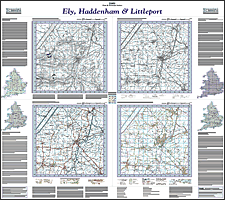
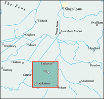
This map includes the following locations
Badgeney,
Barroway Drove,
Barton Bendish,
Barway,
Beachamwell,
Beck Row,
Begdale,
Bexwell,
Black Bank,
Black Horse Drove,
Boughton,
Brandon Bank,
Brandon Creek,
Broad Hill,
Brookville,
Broomhill,
Bunker's Hill,
California,
Chainbridge,
Chatteris,
Chequers Corner,
Chettisham,
Christchurch,
Church End,
Claypits,
Coldham,
Collett's Br,
Colne,
Colnefields,
Coveney,
Crimplesham,
Denver,
Dereham, West,
Doddington,
Downham Market,
Downham, Little,
Dunkirk,
Earith,
Eastwood End,
Elm,
Ely,
Emneth,
Emneth Hungate,
Eriswell,
Feltwell,
Ferry Hill,
Fincham,
Fitton End,
Fodderstone Gap,
Fordham,
Foulden,
Friday Bridge,
Gooderstone,
Gorefield,
Guyhirn,
Guyhirn Gull,
Haddenham,
Haddenham End Field,
Head, West,
Hermitage, The,
Hilgay,
Hill, Broad,
Hockwold cum Wilton,
Holly End,
Holywell Row,
Hook,
Horseway,
Iron Bridge,
Isleham,
Kenny Hill,
Knight's End,
Lakenheath,
Leverington,
Leverington Common,
Little Downham,
Little London,
Little London,
Little Ouse,
Little Thetford,
Littleport,
London, Little,
London, Little,
Lordsbridge,
Manea,
March,
Marham,
Marshland St James,
Mepal,
Methwold,
Methwold Hythe,
Mildenhall,
Mile End,
Murrow,
Narborough,
Nordelph,
Northwold,
Norwoodside,
Ouse, Little,
Outwell,
Oxborough,
Oxlode,
Parson Drove,
Peas Hill,
Pentney,
Prickwillow,
Purls Bridge,
Pymoor,
Pymore,
Queen Adelaide,
Ratten Row,
Ring's End,
Row, West,
Runcton Holme,
Runcton, South,
Salters Lode,
Sandhill,
Second Drove,
Setchey,
Shingham,
Shouldham,
Shouldham Thorpe,
Smeeth, The,
Soham Cotes,
South Runcton,
Southery,
St. John's Fen End,
Stoke Ferry,
Stonea,
Stow Bardolph,
Stowbridge,
Stradsett,
Stretham,
Stuntney,
Suspension Bridge,
Sutton,
Sutton Gault,
Swingbrow,
Ten Mile Bank,
The Hermitage,
The Smeeth,
Thetford, Little,
Thistley Green,
Tholomas Drove,
Thorpland,
Three Holes,
Tilney cum Islington,
Tilney Fen End,
Tilney St Lawrence,
Tips End,
Tottenhill,
Tottenhill Row,
Town End,
Undley,
Upwell,
Walpole Highway,
Walsoken,
Walton Highway,
Walton, West,
Wardy Hill,
Watlington,
Welney,
Wentworth,
Wereham,
Wereham Row,
West Dereham,
West Head,
West Row,
West Walton,
Weston Ditch,
Westry,
White Cross Hill,
Whitington,
Wiggenhall St Mary Magdalen,
Wiggenhall St Mary the Virgin,
Wiggenhall St Peter,
Wilburton,
Wilde Street,
Wimblington,
Wimbotsham,
Wisbech,
Wisbech St Mary,
Witcham,
Witchford,
Wormegay,
Wretton,
|