Great British Cities: Edinburgh (1857-1957)
 |
|||||
|
|
|||||
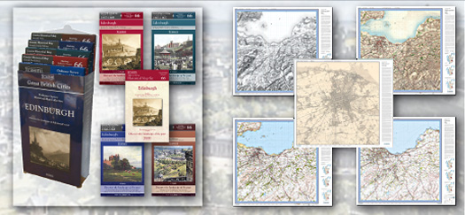
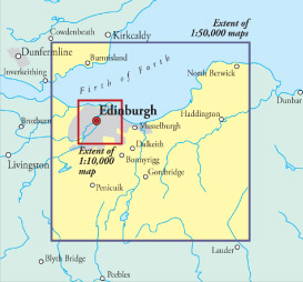
| Discover the landscape of Edinburgh’s past with this fascinating collection of historical maps describing a century in the development of Scotland’s capital city. Four 1:50,000 maps from four different periods give you a series of bird’s-eye views of the city and its surrounding countryside, while a detailed 1:10,000 maps lets you explore the mid-19th century city street by street. |
|||||
| Contains the following maps: • Scottish First Edition (1857-69) • Scottish Third Edition (1905-07) • Scottish Popular Edition (1926-28) • Seventh Series (1957) • County Series 1:10,00 Key features include: • Digitally enhanced cartography • Maps enlarged to match modern scales • British National Grid for ease of reference • Locator map featuring modern-day settlements • Sheet indicator showing maps used • Laminated cover with contemporary illustration • Sheet size: 1000mm x 890mm • Folded size: 135mm x 226mm • Historical notes |
 |
||||
More Details >>